Why Japan’s Michinoku Coastal Trail is the best hike I’ve ever done

Nov 19, 2019 • 8 min read

The 1000km-long Michinoku Coastal Trail was completed in June 2019. Shutterstock
Most of us are aware of the devastating 2011 earthquake and tsunami that decimated a large part of the north east coast of Japan, but few people will know what happened afterwards.
And nor did I. Until one evening, sitting at home, I absent-mindedly started researching cities along the coastline: Natori, Miyako, Shiogama; all of which were annihilated due to the disaster. I discovered that rebuilding in the region was in progress, and that some parts had been completed, including the Michinoku Coastal Trail (MCT).
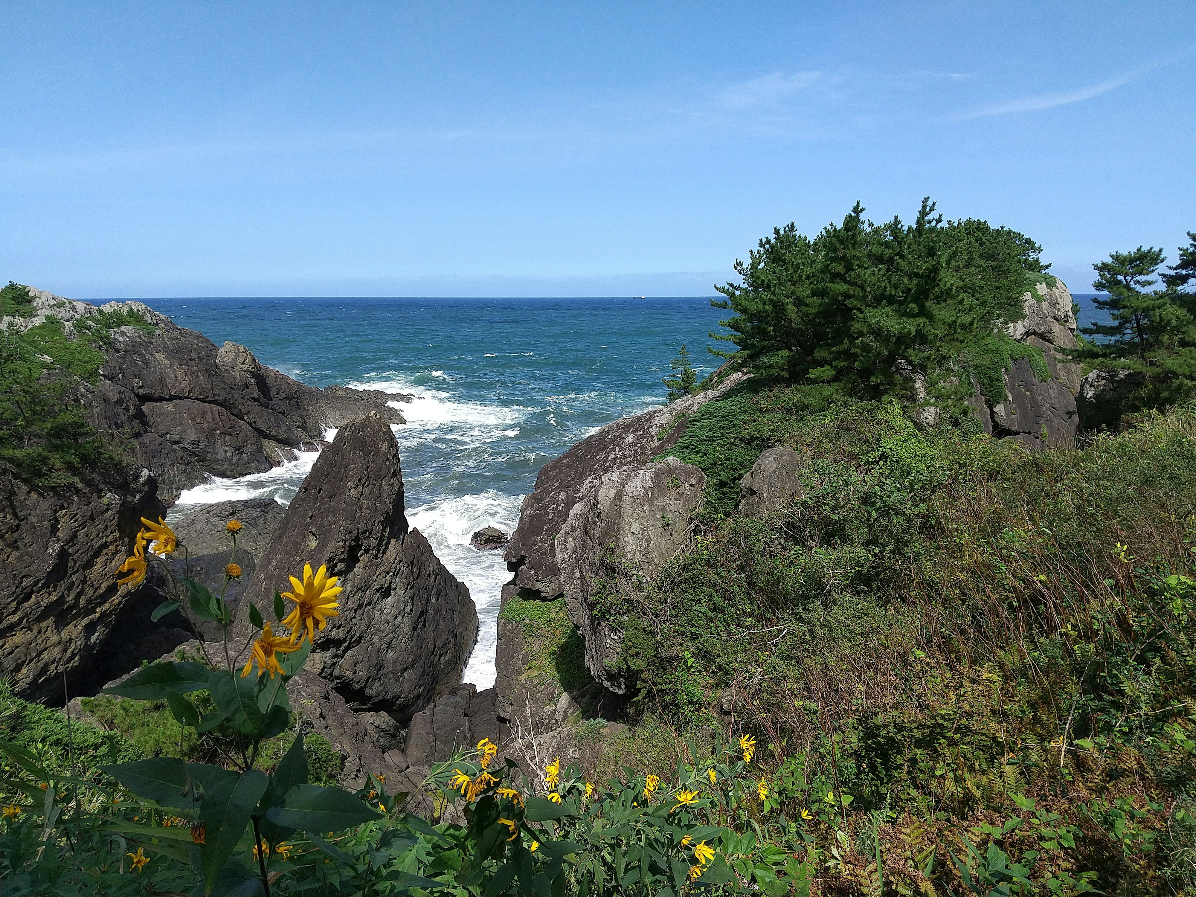
Japan’s newest long-distance hiking route, the 1000km-long Michinoku Coastal Trail opened in June 2019 and connects the city of Hachinohe in Aomori Prefecture with Soma in Fukushima, traversing a large section of the Tohoku region (Northeast Japan), which is still rebuilding after the 2011 earthquake and tsunami disaster. It connects mountain trails and rice field footpaths in low-lying foothills and roadways, offering hikers the opportunity to experience off-the-beaten-track Japan, and contribute to the economy of communities still recovering from the catastrophe.
Within a week of learning about the trail, I was on a flight departing from London Heathrow. Little did I know the impact that decision would have on me.

Stage one: Miyako and the Alps of the Sea
I arrived in the city of Miyako in the northern Iwate Prefecture. Some of the most shocking footage of the tsunami beamed around the world was taken in Miyako. The city has been rebuilt and has plentiful restaurant options, so I stopped at a traditional lunchtime eatery for a soba noodle salad before heading through the quiet city to the visitors centre at Jōdogahama.
I’d contacted the team at the Michinoku Coastal Trail before leaving London and explained that I was keen to see as much of the trail as possible, but that – lamentably – I was unable to take three months out of the office to hike its entirety. They offered to set me up with an MCT guide to show me some of the most important sites along the route.
Despite the onset of jetlag, I was keen to get out and experience the natural highlights of the trail, so I pulled on my hiking boots and – led by my knowledgeable MCT guides Kumi Aizawa and Hiromitsu Seki – headed out through the red pine forest paths in search of the cliffs heralded by locals as the Alps of the Sea.
Within 20 minutes we were at one of the viewpoints, gawping at 200m-high cliffs that looked like something from another planet. Thoughts of Luke Skywalker’s Jedi Hideaway from the Star Wars franchise (actually filmed in Ireland) engulfed my mind.
We hiked the coast for several miles with the swirling blue ocean crashing into jagged sea caves. But the best was still to come.
Miyako’s most dramatic (and Instagrammed) site is the Jodogahama volcanic rock formations, out to sea along the coast of Miyako Bay. The tall, jagged rocks have been carved into unusual shapes by centuries of wind and rain, bringing them fame throughout Japan. Much to the joy of the locals, the formations were miraculously spared by the tsunami waves – other parts of the trail were not so lucky.
Stage two: Ofunato and the Shiome Tsunami Memorial Museum
The following morning – having spent the night on a mattress on the floor at Ofunatocho guest house (which, somewhat surprisingly, resulted in the best sleep I’d had in a week) – we headed to the Goishi coast, in southern Iwate Prefecture, to hike along the beautiful rocky cliffs towards Ofunato city. The walking paths are surrounded by both red and black pines that cut through the cliffs, and offer views of the sparkling turquoise Goishi coastline.
It was in Ofunato that I was introduced to Waichiryo Katayama, known locally as Waichi. His colourful attire matched his good humour, and his zest for life appeared infinite despite the fallout of the events from 2011.
Waichi’s former village, Yoshihama, located on the outskirts of Ofunato, was sizeable enough to have an elementary school and university. Today, only rice fields remain.
After the tsunami Waichi built a memorial museum by hand from wood and furniture he found during the cleanup. Known as ‘Shiome’, the colourful memorial stands in the Okirai area of Ofunato and includes an outdoor play area and a place to relax and have a barbecue.
Over a beer he told me a story about the Okirai primary school, pointing out the spot where it once stood, a few hundred metres from the museum. The school’s main entrance – also its evacuation route – faced the sea, meaning children had to go around the building to get to higher ground.
Mr Takeshi Hirata, a city councillor, made a recommendation to the council to build an emergency evacuation staircase bridge over the main road from the school’s second floor. It was completed in December 2010, just three months before the tsunami hit. All teachers and children evacuated successfully, and the bridge became known as the Miracle Bridge. The staircase is now an exhibition in Shiome – Waichi carried it to the museum on his back.
It was at Shiome that I began to comprehend the loss experienced by people in this part of Japan. It’s impossible not to become emotional when looking at the pictures of the devastation caused to Ofunato. But perhaps more moving is to see how, despite the loss, positives have emerged from the tragedy.

Stage three: Sendai and the man who marked the trail
That evening we headed to the capital city of the Miyagi Prefecture, Sendai, the largest city in the Tōhoku region. Sendai was the closest major city to the epicentre of the earthquake. Its coastal outskirts were devastated, but the city remained largely unscathed.
Sendai is full of life; giant shopping malls, neon lights and streets filled with restaurant workers vying for our attention. Having just hiked the more remote sections of the trail – which then passes directly through the city – I felt a little overwhelmed.
As we dined on plates of sukiyaki (a one pot dish of beef, vegetables and tofu with a sweet soy sauce) and sashimi (raw fish without rice) at a local restaurant, I learned that the concept of the MCT had come together when the area began rebuilding after 2011. It was imperative that the regions, largely unknown to mainstream tourism, developed a way to entice people to the area and provide a new source of income. Due to the region’s natural splendour, a walking trail made sense, and soon locals from towns and villages along the proposed route got involved in the initiative.
Chief among them was Yusuke Sakuraba from the Ministry of Environment. With his young son strapped to his back, Yasuke took on the task of marking the first 750km of the walkway himself; an impressive feat, and an anecdote that epitomises the effort local people have put into making this new walking route a success.
Stage four: an infamous end point
My time on the trail nearing its end, we drove south along the coast to Fukushima.
When the tsunami struck here in 2011, waves swept over the seawall of Fukushima Daiichi Nuclear Power Plant and caused three nuclear meltdowns, multiple explosions and the leaking of radioactive materials into the atmosphere, leading to a 20km-wide evacuation zone around the plant and one of the deepest scars caused by the natural disaster.
While this one moment has defined the public perception of Fukushima, the region can now boast a new, more positive, claim to fame: as the end (or start) of the MCT. And it makes for a beautiful one: a rugged, mountainous landscape, with small towns and villages dotting the coastline.
We drove towards the small city of Soma, the trail terminus proper, where a dilapidated primary school stands close to the coast. Kumi explained that when the tsunami waves came in all the teachers and children made it onto the roof, where they sat for three days waiting to be rescued. Nearby, a group of workers flatten the road for the region’s new highway, which curves its way around a pond filled with water lilies.
Though I only managed to experience a tiny part of the Michinoku Coastal Trail, it left a greater impression on me than trails I’ve spent much longer tackling.
You can’t help but feel moved walking through these landscapes – blemished but beautiful – and humbled by the resilience of the people who call them home. To me, the MCT feels like an embodiment of this region’s unbreakable spirit, and, for this reason, it’s hard to imagine the project being anything other than a success.
How to hike the trail yourself
The single track Michinoku Coastal Trail connects Hachinohe in Aomori with Soma in Fukushima, with the entire trail taking around 44 days to complete on foot (so most opt for just a section). It’s best to hike the MCT during spring (March to June) and autumn (Sept to Dec) as summer is hot and humid and in winter it's covered with snow.
Accommodation is plentiful (and locals will often invite you to pitch a tent in their gardens!). Guides aren’t mandatory, but their knowledge helps you get more out of the trail and they can recommend local places to stop. For more information, and details on hiring a guide, visit the official MCT website.


