The 8 best hikes in Guatemala, from volcano trails to jungle jaunts
Apr 24, 2022 • 10 min read

Gautemala's best hikes climb up volcanoes and Mayan pyramids © Simon Dannhauer / Shutterstock
With its dramatic volcanic topography, Guatemala is a hiker's dream come true. From glowing lava flows and stunning crater lakes to emerald jungles, the entire country is a feast for the eyes, and the summits of Guatemala's mountains and volcanoes are the perfect places to pause and take it all in.
Most of the country’s best treks are located in the highlands, a region defined by a chain of smoking volcanoes to the south and the Sierra de los Cuchumatanes mountain range to the north. With the high elevation, hikers pass through a striking range of vegetation zones, from tropical jungles and pine forests to the altiplano, where everything is wrapped in a shroud of mist.
In the northern jungles of El Petén, multi-day treks take visitors to the ruins of the largest recorded Mayan city, accessible only on foot, where ancient pyramids are swallowed by lush vegetation and haunted by howler monkeys and chittering toucans.
Here are eight of the best hikes in Guatemala for those who love to climb the highest peaks and explore the densest jungles.
The practicalities of trekking in Guatemala
While treks abound, getting to the trailheads for many of Guatemala’s best hikes can be a little tricky, especially if you don’t speak Spanish. The trails themselves can also be confusing, particularly in the tropical lowlands, so we recommend hiring a local guide to show you the way. Guides are easy to find in most areas popular with trekkers – ask around at your accommodation or contact local tour agencies.
Though hiking is a popular activity in Guatemala, you may have the trails all to yourself in some areas, and an experienced guide will reduce the chances of accidentally taking a wrong turn or running into trouble. Guatemala’s weather is generally temperate but the tops of volcanoes can get chilly (below freezing sometimes), so bring a few extra layers, no matter how short the trek.
Volcán Acatenango
Best volcano hike
18km (11 miles) round trip, 6–8 hours or overnight, challenging
Trekking to the summit of 3976m (13,045ft) Volcán Acatenango is probably the most talked-about travel experience in Guatemala – and with good reason. This overnight hike provides dramatic views of glowing orange lava erupting from nearby Volcán El Fuego against the backdrop of an impossibly starry sky.
The hike is not technically difficult, but the trail is steep and the terrain varied, so it’s considered tough, even by the standards of experienced hikers. Expect a walk that cuts through farms and cloud forests and crunches over volcanic gravel before leveling out at a sandy crater with views of surrounding volcanoes and the Cuchumatanes mountains.
Most guides set up tents for the night at the base camp below the summit, for a direct view of El Fuego. The next morning, you can climb to the peak to watch the sunrise. Acatenango can also be hiked in a single day, but without the overnight stay, you'll miss the best part of the show.

Volcán Pacaya
Best hike near Guatemala City
6km (3.7 miles) round trip, 2–3 hours, moderate
Volcán Pacaya is Guatemala’s most popular hike, being short, moderately easy and close to Antigua (and not far from Guatemala City). For the same reasons, the trail is a favorite with trail runners, so don’t be surprised if you see athletes whizzing by as you amble up the trail.
The first hour of hiking is the hardest because of the steep gradient of the trail, which takes you through forests and farmland. After that, it’s a fairly painless climb uphill to reach lava fields that have cooled enough to walk on, but are still hot enough to roast marshmallows – guides can provide them, but if you're hiking on your own, pick up a bag from one of the vendors at the beginning of the trail.
One of the nice things about the Volcán Pacaya trek is the number of resting points along the way, most with vendors selling drinks and local snacks such as oranges sliced in half and topped with ground pumpkin seeds.
If you're concerned about having enough stamina to make it to the top, it’s possible to hire someone to walk beside you with a horse that you can ride if you get tired, for a modest fee. The summit provides amazing views of neighboring volcanoes Agua, Fuego and Acatenango. Many companies combine the hike with a visit to the nearby Santa Teresita thermal pools, for a soak in the hot water after the hike.
Volcán Tajumulco
Best hike for bragging rights
13km (8 miles) round trip, 6–8 hours, challenging
Rising to a whopping 4200m (13,780ft), Volcán Tajumulco is not only the tallest volcano in Guatemala, it's the highest point in Central America. Conquering the summit is a badge of honor that experienced hikers won’t want to miss. Despite Tajumulco’s impressive height, it only takes about five hours to reach the top; if you are lucky enough to have clear skies at the summit, you'll be rewarded with views of both Mexico and El Salvador on either side.
The Volcán Tajumulco hike is more technical than other trails in Guatemala. In parts, it’s necessary to maneuver over boulders and rocky outcrops, and the trails are not well marked, so it’s essential to go with a guide. Arrange your adventure in Quetzaltenango, where you should stop for a couple of days to acclimatize before climbing Tajumulco.

Laguna Chicabal
Best hike for serenity
7.5km (4.6 miles) round trip, 3–4 hours, easy
Laguna Chicabal is an easy day trip from Quetzaltenango and the hike to this attractive crater lake can be completed without a guide. A moderately steep hike of about two hours takes you to a mirador (viewpoint) looking out over the crater. From here, a descending staircase will bring you to the edge of the lagoon, a serene spot with spiritual significance for the indigenous Mam Maya people of the region. The edge of the water is often adorned with flowers that people have left as offerings, and you may see visitors quietly praying.
The lagoon is surrounded by cloud forest and has views of the nearby Santa Maria and Santiaguito volcanoes, but because the lake is sacred, swimming is prohibited at all times. To get to the trail, take a local bus going to the village of San Martin Sacatepequez. You'll be dropped off about 2km (1.2 miles) from the dirt road that leads to the lagoon; ask locals to show you the way to the trailhead.
Most hikers leave Quetzaltenango at dawn to reach the lagoon before the mist rolls in, which typically happens at around 10am. However, the lake is still a beautiful place to visit even when shrouded in fog. There are restrictions on visiting the lake during the first two weeks of May because of ceremonies held by the Mam people. Be sure to ask around before trying to head to the lagoon at this time of the year.
Cerro del Rostro Maya (Indian Nose)
Best hike to see the sunrise
3km (1.9 miles) round trip, 1–2 hours, moderate
The hilltop known as Cerro del Rostro Maya is the perfect hike to break up lazy days spent on the shores of Lago de Atitlán, and it's also the most popular place to see the sunrise over the lake. Expect a short and steep trek uphill, with a lot of effort in a little time but a big reward in the form of epic views of Atitlán backed by a trifecta of volcanoes – San Pedro, Toliman and Atitlán.
Cerro del Rostro Maya is located between the villages of San Juan la Laguna and Santa Clara and you can walk to the top from either side in around 40 minutes. Although the hike is straightforward, it’s worth taking a guide along for an introduction to local folklore (and to avoid the competing locals who try to charge tourists a fee to reach the summit).
Most guides will bring a breakfast picnic for the top. For those coming back down through San Juan La Laguna, there are plenty of excellent cafes where you can reward yourself with a coffee for completing the hike.

Quetzaltenango to Lago de Atitlán
Best hike for adventure
46km (28.5 miles), 3 days, moderate
The three-day trek through the western highlands from Quetzaltenango to Lago de Atitlán is the most popular multi-day hike in Guatemala, and that's partly because of the excellent job local outfit Quetzaltrekkers does of running it. The walk starts in Quetzaltenango and takes hikers through cornfields, coffee plantations and cloud forests to the shores of stunning Lago de Atitlán.
You'll stop overnight in small villages, where you can eat dinner with locals hosts, experience a local sauna and relax by the fire. Although this hike has a few steep stretches, most sections of the trek are only moderately difficult; the only challenge is the overall length of the walk.
The hike ends at Cerro del Rostro Maya, where all your hard work is rewarded with an unforgettable sunrise over Atitlán. After sunrise, hikers descend to a coffee plantation in San Juan La Laguna for a caffeine fix before finishing up at a bar overlooking the lake in San Pedro La Laguna for lunch, celebratory beers and a swim.
Volcán San Pedro
Best hike for a challenge
6.5km (4 miles) round trip, 4–6 hours, challenging
For anyone relaxing on the shores of Lago de Atitlán, it’s only a matter of time before thoughts start to creep in about ascending the mammoth peak of Volcán San Pedro. The climb up this 3020m (9908ft) volcano is one of Guatemala’s most challenging hikes because of the steep gradient. The trek can be completed in half a day, but the walk is no easy feat.
The trail winds through coffee and avocado farms, cornfields and cloud forests before opening up at the summit to reveal an expansive view of the lake that is well worth the effort of getting here. The volcano was classified as an ecological park in 2006, and the trailhead is in the village of San Pedro La Laguna, where the visitor center has information about the route.
You'll have to pay a fee at the visitor center to enter the park. Like most other hikes in Guatemala, the trail up San Pedro is best attempted with a guide, who can help you navigate this often challenging trip.

El Mirador Jungle Trek
Best hike for history lovers
40.5km (25 miles) round trip, 5 days, challenging
The five-day El Mirador jungle trek is one of Guatemala's best unsung adventures, and it’s perfect for those who love to walk but aren’t big fans of steep inclines and heights. Nevertheless, the trek is difficult because of its length and the heat, mud and mosquitoes, rather than any steep climbs en route.
Starting in the tiny village of Carmelita, near the town of Flores in the El Petén jungle, guides lead hikers along a crude mud path (hard or wet, depending on the season) that snakes through the heart of the rainforest. You'll camp at designated sites along the way, immersed in the sounds of the forest.
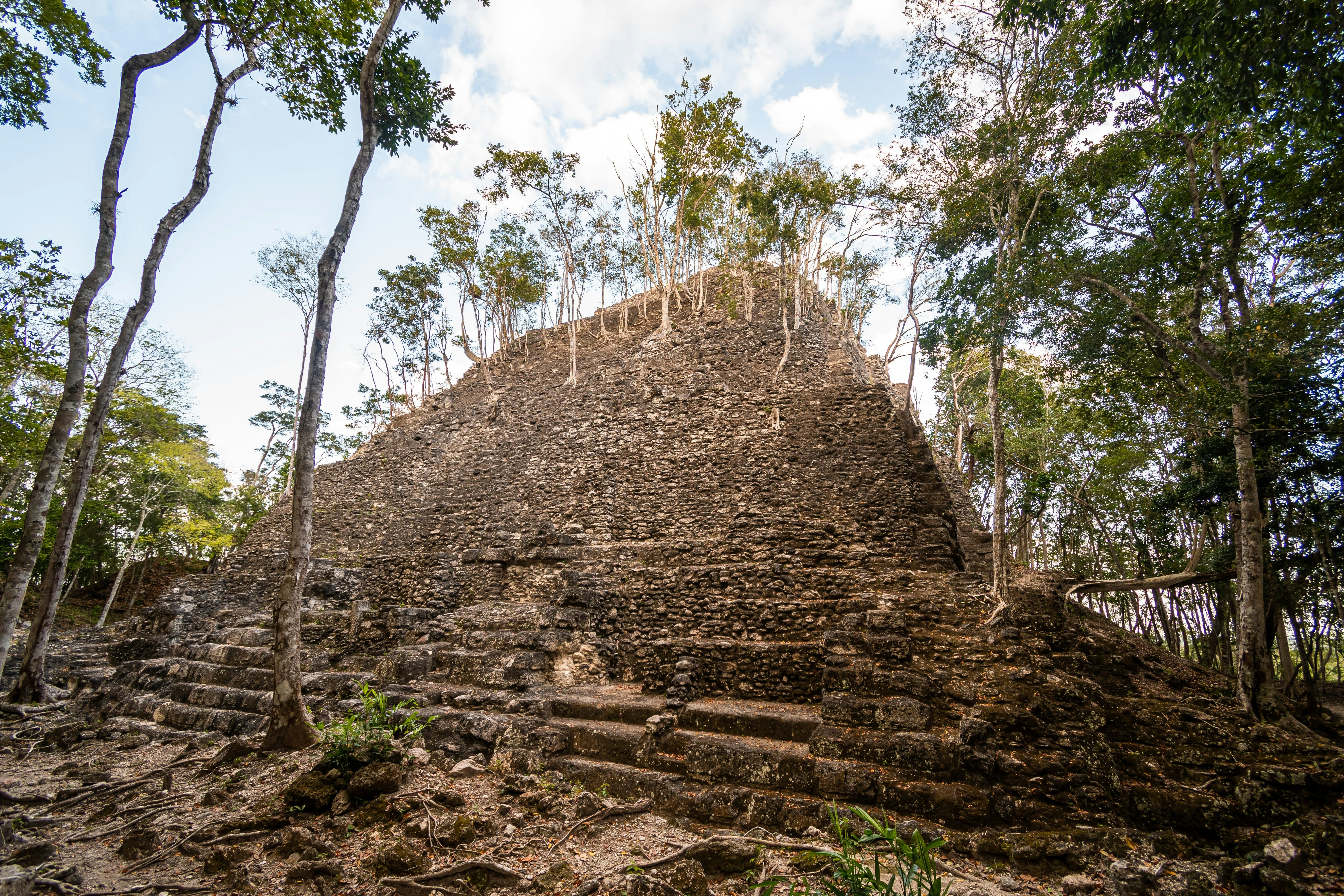
Along the route, you’ll stop at several smaller ruins before you reach the star of the show: El Mirador, the largest and oldest Mayan city in Central America. Stretching for nearly 9km (5.6 miles), this recently excavated archeological site has more than 800 jungle-choked structures to explore, including La Danta, which at 72m (236ft) is one of the largest pyramids in the world.
You may also like:
The best times to visit Guatemala for festivals, jungle encounters and temple trips
Getting around Guatemala is travel in vivid color
The best places to visit in Guatemala, from Mayan ruins to smoking volcanoes


