Advertisement
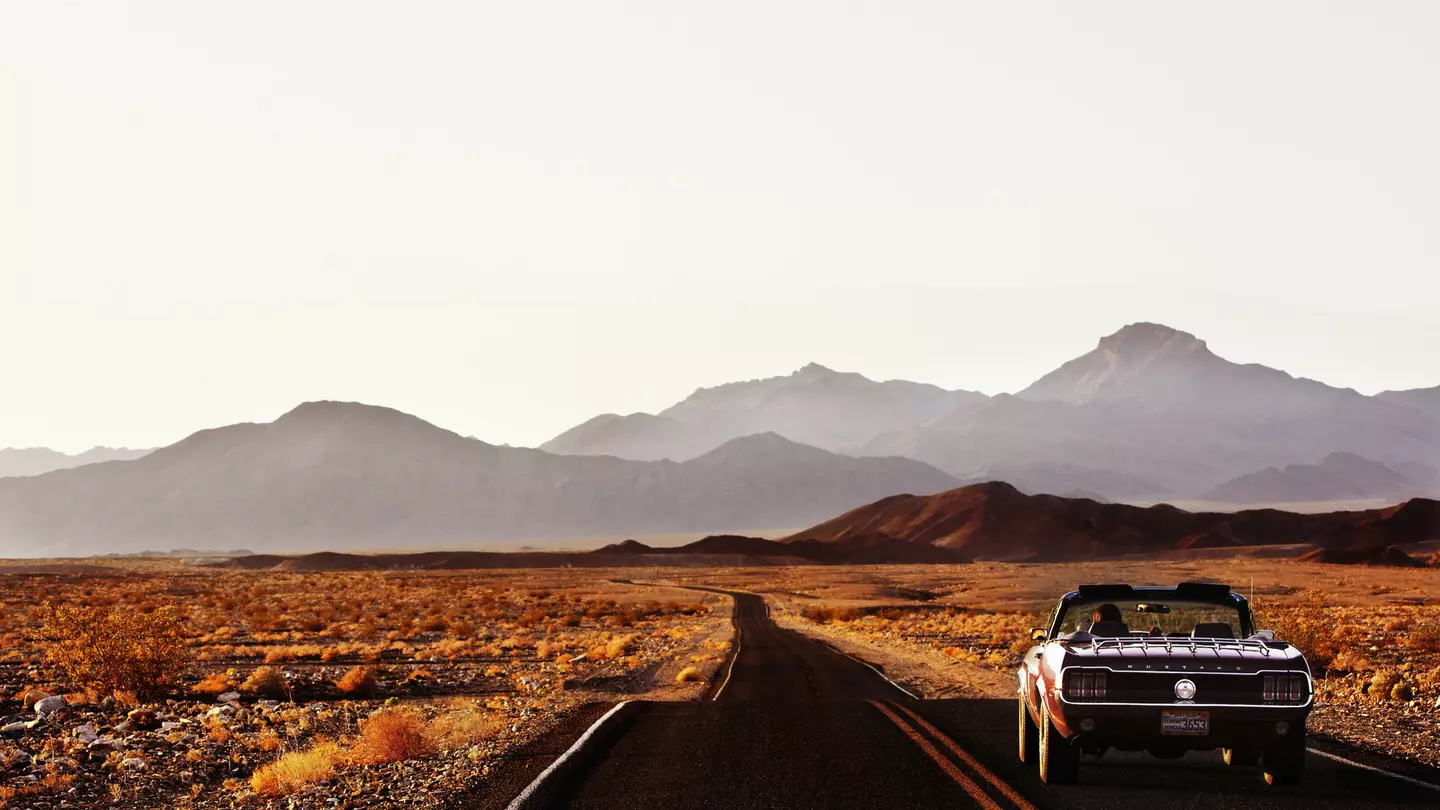
Death Valley is not the barren, lifeless landscape that its name suggests. Mark Read/Lonely Planet
This is the ultimate California road trip, a north–south route tracing the eastern slope of the mighty Sierra Nevada. The Eastern Sierra Scenic Byway (Hwy 395 officially) runs the entire length of the range, and turnoffs that dead-end at the foot of the mountains deliver you to pristine wilderness and countless trails, including the famous Pacific Crest Trail. Hwy 395 passes near the highest and lowest points in the continental USA, plus three national parks and the back entrance to Yosemite National Park (summer only).
Start by tracing the western shore of Lake Tahoe and you’ll witness the landscape’s full transformation from clear, icy blue lakes bound by pine forests and lush meadows to hot springs, glacier-gouged canyons and the brain-melting extremes of Death Valley.
It’s no wonder that the eastern Sierras are suddenly on everybody’s to-do list. Get your road trip going with this guide to Hwy 395, including four key stops and what to see and where to eat and stay along the way.
Advertisement
Trip length: End to end, this road trip covers over 360 miles. Without a single stop, you could drive it start to finish in under 7 hours. But spreading it over at least 4 days – possibly adding an extra day at any point along the route – will prove more than rewarding.
When to arrive and where to end: Start in Truckee, northwest of Lake Tahoe, and conclude in Death Valley.
Things to know: Weather at elevation can be unpredictable; monitor updates from CalTrans to see if any part of your route is affected.
What to pack: Anything goes in California when it comes to fashion, but prepare for variation in temperatures. The mountains can be cold and deserts blazing hot. Plan on comfortable base layers and have a light jacket at the ready. Comfortable and sturdy walking shoes are essential for trails
Stop 1: Lake Tahoe
Vibes: Lakeside life changes as you road-trip around Lake Tahoe's shoreline. The north (Tahoe Vista, Incline Village) is quiet and upscale, the west (Tahoe City) is rugged and old-timey, and the south bustles with things to do, motels and casinos.
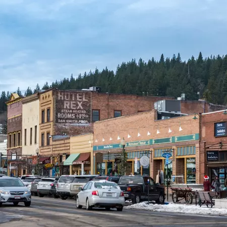
Start the day’s 45-mile journey in Truckee, a ski bum’s hangout northwest of the lake that has morphed into a gourmet hot spot, and loop down Hwy 89 to South Lake Tahoe.
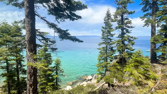
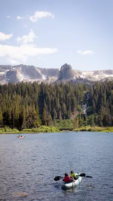
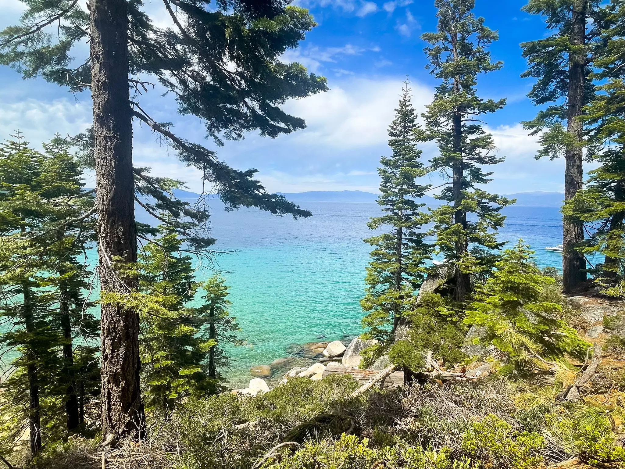
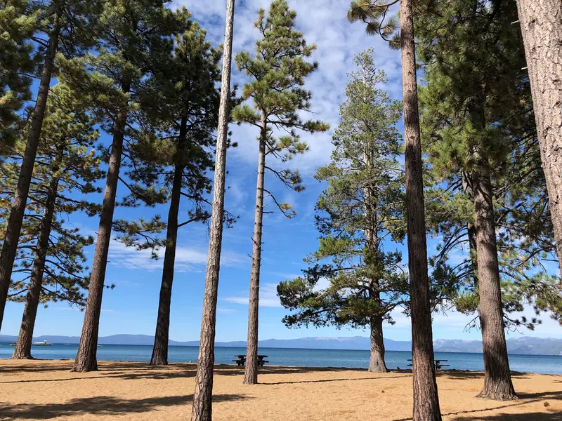
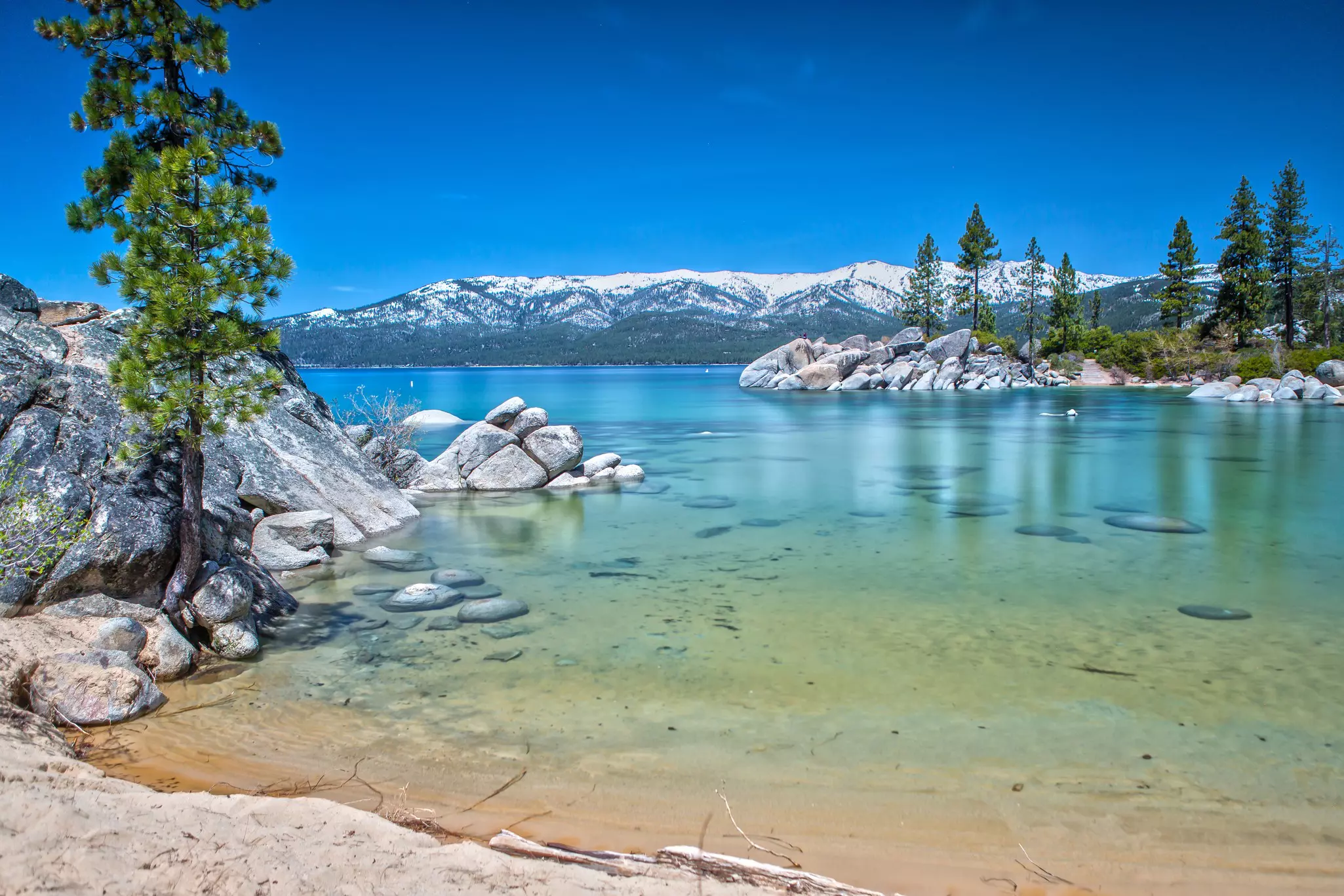
Do: The startlingly clear blue waters of Lake Tahoe, a deep-blue jewel framed by jutting peaks, invite splashing, kayaking and even scuba diving. Mountain bikers can careen down epic single-track runs, and hikers can follow trails through thick forests to staggering views.
The Granite Chief Wilderness, north and west of Tahoe City, has an appealing variety of hiking trails, including the moderately strenuous Five Lakes Trail and the easy trek to Paige Meadows. (Paige Meadows is also good terrain for novice mountain bikers.) If it’s winter, simply replace hiking with snowshoeing and mountain biking with skiing at resorts like the enormous Palisades Tahoe, with its thronging Olympic Valley and its chiller Alpine Meadows.
In South Lake Tahoe along Emerald Bay Rd (Hwy 89), the shores of Pope, Kiva and Baldwin Beaches will surely beckon, but if you are thinking of taking a dip, brace yourself: the clear waters of Lake Tahoe are brisk, if not frozen, for much of the year, with peak temperatures in late summer maybe cracking 70°F (21°C) in the shallows.
To enjoy the lake from the surface, you can rent powerboats to paddleboards at marinas all along the south shore, or see it from above with Lake Tahoe Balloons.
Eat: Fill up on incredible omelets for breakfast at Squeeze In in Truckee, then pick up stacked sandwiches at the Full Belly Deli for a picnic later in the day. Or stop for lunch in Tahoe City for creative pub eats and an outdoor patio within view of the lake at Tahoe National Brewing Company. Settle in on the deck at Himmel Haus in South Lake Tahoe for dinner and toast hefty steins filled with German beer over schnitzels.
Stay: Wylder Hotel Hope Valley, 20 miles down Hwy 89 from South Lake Tahoe, has snug pine cottages, yurts and camping, plus a wealth of activities Right on the lake, Camp Richardson runs a complex of cabins, campsites and motel rooms, plus its own beach and marina.
The drive (147 miles, 2 hours and 50 minutes with no stops): Continue south on Hwy 89 from South Lake Tahoe toward Topaz to join Hwy 395, or cross over into Nevada on Hwy 50 and pick up Hwy 395 north of Dresslerville, then go south for 115 miles to Mammoth Lakes.
Advertisement
Stop 2: Mammoth Lakes
Vibes: The lesser-explored eastern side of the Sierra is a compelling amalgam of high desert, rural towns and blissfully empty space, backed by some of the tallest mountains in the contiguous USA.
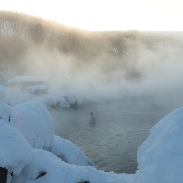
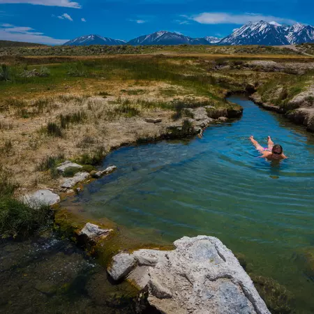
Do: Soothe aching muscles at secluded Buckeye Hot Spring, near Bridgeport, about 1 hour and 45 minutes from South Lake Tahoe. It has piping-hot pools beside Buckeye Creek – handy for a cooling dip – and a clothing-optional policy. If that’s not your speed, the natural pools in Travertine Hot Spring rest amid impressive rock formations.
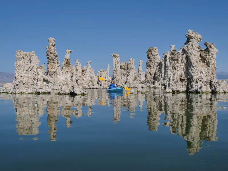
Renewed to return to the road, continue south for 25 miles to the quiet and mysterious Mono Lake. The glassy surface reflects jagged Sierra peaks, young volcanic cones and the unearthly tufa towers that make the lake so distinctive. The visitors center north of Lee Vining has exhibits on the lake’s wildlife and geology, and rangers give patio talks and lead excellent walking tours from the South Tufa area on the lake’s rim. You can rent a kayak at Navy Beach, so you can paddle up close and check out the tufa formations yourself.
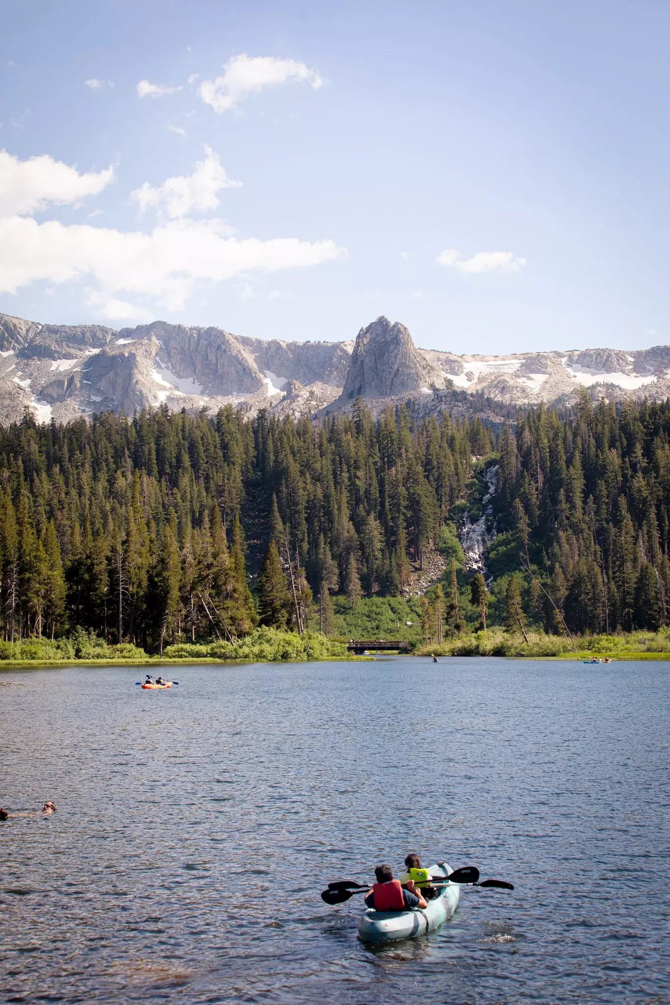
Stop for the day in Mammoth Lakes, a year-round resort town where ski season can run into June and the land is keen to remind you of the region’s active and ongoing evolution. At Hot Creek Geological Site, steaming, bubbling cauldrons of water shimmer in tropical shades of blue and green, and at Earthquake Fault, a sinuous half-mile-long fissure gouges a crevice 20ft deep into the earth.
Eat: The Getaway Cafe, tucked south of Hwy 50 in South Lake Tahoe, presents an outstanding breakfast menu, with four kinds of French toast, three choices of eggs bene, a slate of Mexican dishes (including red chilaquiles with chorizo) and, since it is still California, its own blend of granola. Make a pit stop at the Whoa Nellie Deli (closed in winter), a gas station/restaurant in Lee Vining famous for its views of Mono Lake, live bands and amazing food. Classy Convict Lake Resort near Mammoth Springs is sure to impress – order the fresh rainbow trout for dinner.
Stay: Not quite 6 miles off Hwy 395, the two-bedroom log cabins and balcony hotel rooms at Double Eagle Resort and Spa exude rustic elegance.
The drive (100 miles, 1 hour and 30 minutes with no stops): Continue south on Hwy 395 to Lone Pine.
Stop 3: Lone Pine
Vibes: The Old West rides again at filming locations in the increasingly barren, windswept landscape.
Do: You could easily pass a few days hiking, cycling, fishing and climbing around Bishop, 40 miles south of Mammoth Lakes. Certainly stop in the Laws Railroad Museum and Historic Site, where you can sift through relics of the Old West and explore antique railcars.
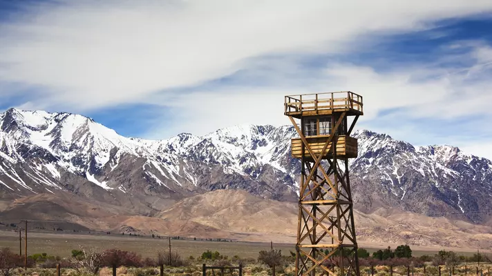
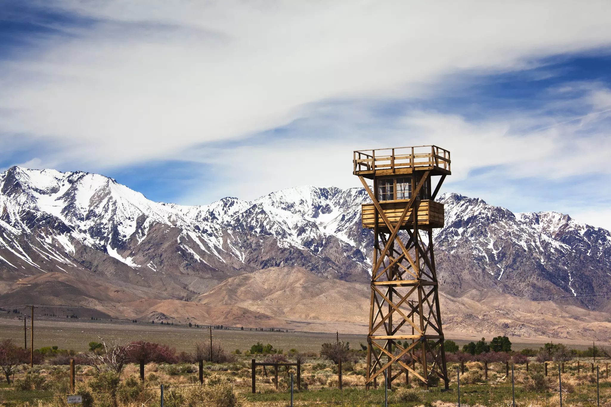
Another 40 miles further, near the tiny town of Independence, is the Manzanar National Historic Site, where thousands of Japanese Americans were incarcerated by the US government between 1942 and 1945. A stark wooden guard tower alerts drivers to veer off Hwy 395 and enter the camp’s only remaining building, the former school auditorium. The superb interpretive center screens a 22-minute documentary, and on a self-guided 3.2-mile driving tour, visitors can explore a recreated mess hall, barracks and latrine, as well as the haunting cemetery.
The spotlight turns to movie history in diminutive Lone Pine. The Museum of Western Film History displays paraphernalia from the scores of movies shot in the orangey earthen mounds of the Alabama Hills.
Lone Pine is the base for the main Mt Whitney Trail (the easiest and busiest one), which starts at Whitney Portal, about 13 miles west of Lone Pine and climbs about 6000ft over 11 miles. It’s a super strenuous and really, really long walk that’ll wear out even experienced mountaineers.
Eat: A string of fast-foot joints and casual spots line the highway through town.
Stay: The Whitney Portal Hostel and Hotel has affordable dorms and modern motel rooms with views of Mt Whitney.
The drive (97 miles, 1 hour and 45 minutes): Veer off Hwy 395 onto CA 190 into Death Valley National Park.
Stop 4: Death Valley
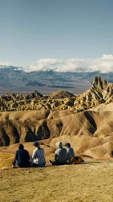
Vibes: Despite the ominous name, Death Valley’s vast desertscapes are alive with geological wonders. Between the hexagonal quilt of salt flats at Badwater Basin, the startling greens and pinks of Artists Palette, the wind-shaped sand dunes and the smooth marble-walled slot canyons, this national park may radically morph what the word “desert” means to you.
Do: Entering the park from the west, stop at the Father Crowley Vista Point on Hwy 190 for a view into Rainbow Canyon. Next, turn right onto Panamint Valley Rd and drive 15 miles before hanging a left onto Wildrose Canyon Rd; drive to the end of the road and wander to the 1870s beehive-shaped charcoal kilns. Head back to the junction with Emigrant Canyon Rd and go north until you rejoin Hwy 190.
Past Stovepipe Wells, blaze your own trail through the fascinating, ever-shifting Mesquite Flats Sand Dunes. Then press on past Furnace Creek, taking the turnoff down Badwater Rd to drive 17 miles to North America’s lowest point, Badwater Basin. Walk the half mile out to the alien-looking salt flats, then backtrack up the road for the short detour onto Artists Dr to take in the colorful mineral hillsides of Artists Palette.
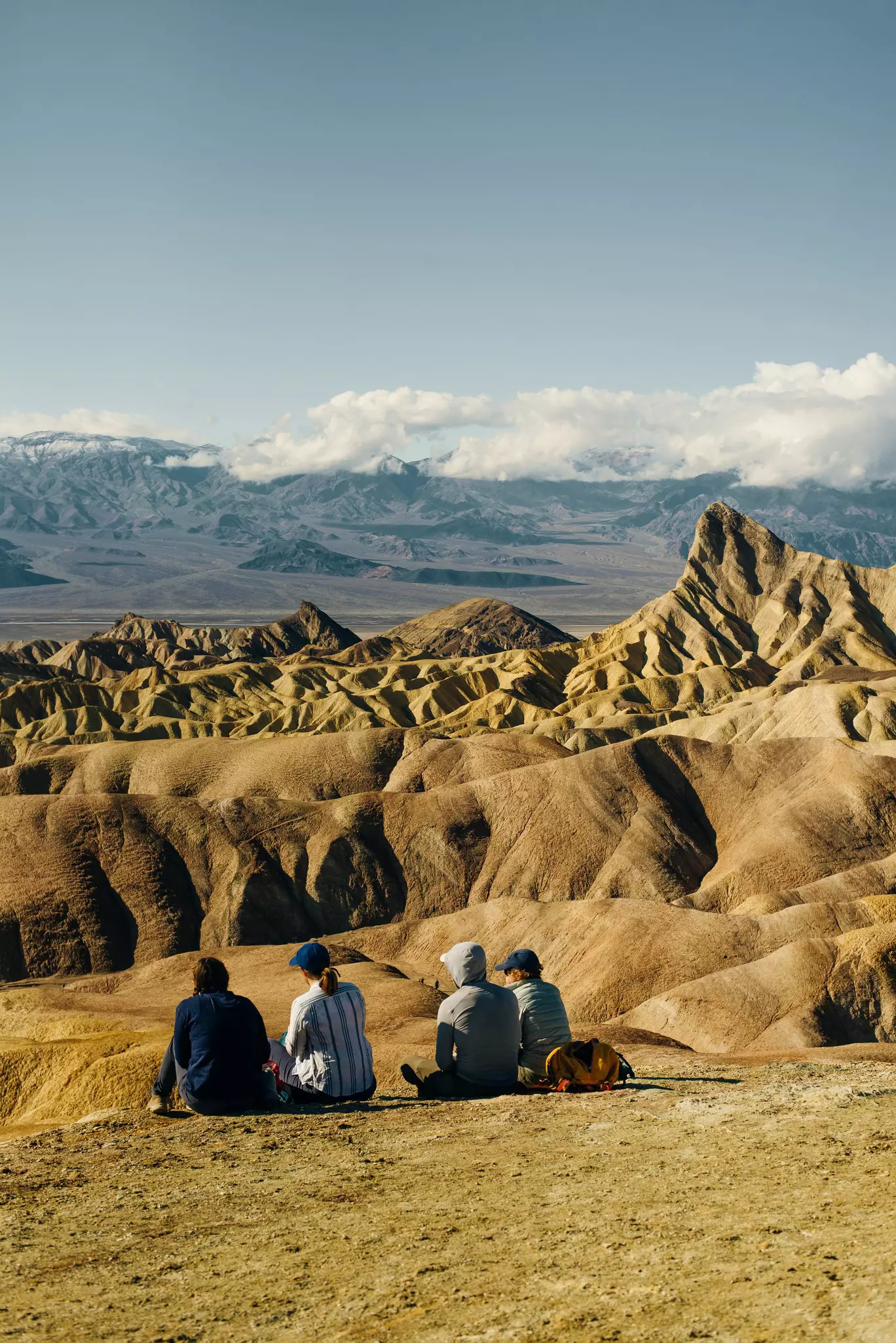
Return to Hwy 190, now veering southeast, stopping at Zabriskie Point for classic views of the badlands below in all their gorgeousness. Try leaving enough time to drive the 14-mile road up to Dante’s View for a dramatic look down on Badwater Basin and Death Valley before leaving the park.
Eat and stay: Panamint Springs Resort has comfortable, rustic rooms and cabins, plus a restaurant and bar, on the park’s west side.
This article was adapted from Lonely Planet's California guidebook.
Advertisement